Photos
China releases adapted nationwide map
Updated: 2011-08-26 08:00
By Wang Qian (China Daily)
BEIJING - China released its first 1:50,000 scale nationwide map on Thursday.
 |
|
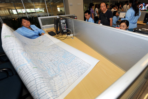
A worker at the National Geomatics Center of China in Beijing shows a map to visitors. China released its first 1:50,000 scale nationwide map on Thursday. [Photo/China Daily] |
"The map provides detailed information, such as land features and village names updated since 2005, and will play an important role in economic development, environmental protection and disaster relief," Li Weisen, deputy director of the National Administration of Surveying, Mapping and Geoinformation, said at a news conference.
The 1:50,000 scale map provides the latest information on the nation's development, especially in the western region, which has enjoyed a fast pace of development in recent years, Li said.
For example, in the Xinjiang Uygur autonomous region, the Tarim River management will be able to benefit from the 1:50,000 map, which will aid the assessment process for key programs such as water resources, the mining industry and road building, said Tian Jiangrong, assistant to chairman of the Xinjiang Uygur autonomous region.
Xinjiang is China's largest administrative division, spanning over 1.6 million square kilometers of land, including 750,000 square kilometers that are unsuitable for habitation.
The newly unveiled map is expected to help speed up economic development dramatically in Xinjiang, as more than 700 billion yuan ($108 billion) is pouring in from the major State-owned enterprises.
Without basic geological information, too much preparation work, which includes mapping the area before the construction of railways, expressways and major programs, needs to be done, explained Zhang Jixian, president of Chinese Academy of Surveying and Mapping.
The comprehensive and detailed information in the map will accelerate the preparation period before launch of these programs, Tian added.
The 1:50,000 map is just a beginning as China is also planning to introduce 1:10,000 and 1:5,000 nationwide maps.
Song Chaozhi, deputy director of the National Administration of Surveying, Mapping and Geoinformation, told China Daily that before 2020 the 1:10,000 map covering the country's land region will be finished.

Specials

Biden Visits China
US Vice-President Joe Biden visits China August 17-22.

Star journalist leaves legacy
Li Xing, China Daily's assistant editor-in-chief and veteran columnist, died of a cerebral hemorrhage on Aug 7 in Washington DC, US.

Hot pots
Tea-making treasures catch the fancy of connoisseurs as record prices brew up interest