Measuring West China with feet
Updated: 2011-09-14 07:23
By Wang Qian (China Daily)
|
|||||||||
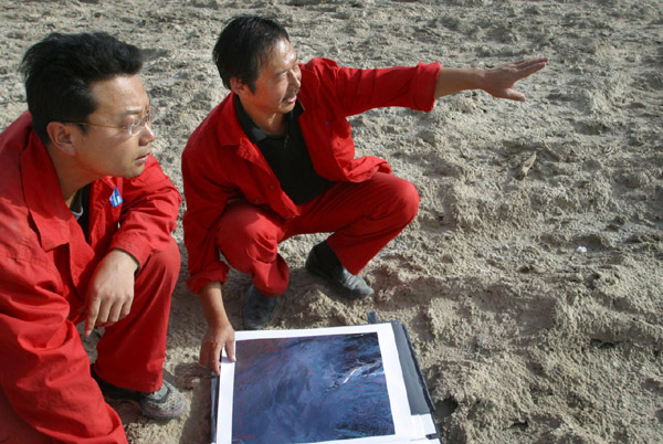
URUMQI - Looking like another blazing sun, Guo Jianhua stands in his fiery red uniform under the scorching sun to measure the sea level of a road near Urumqi county, Northwest China's Xinjiang Uygur autonomous region.
 |
|
Guo Jianhua (right), a senior surveying and mapping technician, works in the Lop Nur area in October, 2007.[Photo/China Daily] |
"We are measuring our country with our feet, step by step," the senior technician from the Xinjiang Bureau of Surveying and Mapping, who has worked in the field for three decades, told China Daily.
Guo, 54, is one of 7,500 workers involved in a State surveying and mapping program since 2006. The program covers more than 2 million square kilometers of depopulated zones in West China including Sichuan, Yunnan, Gansu and Qinghai provinces, as well as the Xinjiang and Tibet autonomous regions.
"I often climb up to the area between 4 km and 5 km above sea level in the Kunlun Mountain Range. I've walked into the hinterland of the Taklamakan Desert with the temperature reaching 70 C at noon and dropping below zero at night," Guo said.
Every year, he goes to dangerous areas like high mountains, hot deserts and cold glaciers to survey and map for about 10 months. His common meal is instant noodles, naan bread and pickles.
"Every surveying and mapping worker has been so close to death. The difference is that some survive, while others don't," he said.
During the 1950s and 1980s, approximately 42 surveying and mapping workers lost their lives, and at least 100 became disabled due to lack of equipment and technological support, according to the National Administration of Surveying, Mapping and Geoinformation.
Guo still remembers the frustration when his car got stuck on the way to the Kunlun Mountain Range in August 2008 with the nearest village 300 km away.
"For hours, I could see nobody. I tried every means, including digging sand and putting stones between the tires and the sand, but it was useless and I felt exhausted. The place is 5 km in altitude, and I was worn out after I carried a stone the size of a football, which felt 10 times heavier," Guo said.
After hours of waiting, another surveying and mapping car found him.
Besides the unexpected dangers like meeting wolves and getting lost, during their three-month stay in the Kunlun Mountain Range, Guo and his team were tortured every day by low atmospheric pressure with oxygen only 40 percent of lower altitudes, as well as by exhaustion, extreme cold and climbing hazards.
"Every night I would wake up because of suffocation and the thing I treasured the most at that time was to have a good and long sleep," Guo said.
He once surveyed and mapped at the side of a board saying "death zone" on the Kunlun Mountains.
Death zone refers to the area 8 km above sea level, where the temperature can dip to very low levels, resulting in frostbite of any body part exposed to the air.
Guo has walked through the death zone, while his colleague Zeng Miaoxin, 52, carried out the body of his friend from the Ili River in October, 1993.
"Our boat was capsized in extremely cold water by a strong wind. The body wasn't found for two days until it floated near the bank," Zeng said.
He still remembers the piercing coldness of the water and the soft body on his back - a 22-year-old man who had just graduated from university.
Now every surveying and mapping worker wears a shining red uniform during field work to stand out.
Li Shaoqun, a 43-year-old surveying and mapping worker, told China Daily that sometimes the loneliness of the place drives him crazy.
"In the wide desert, besides several red spots, all you can see is the yellow sand and the blue sky," he said.


