China gathers high-tech surveillance data on islands
Updated: 2014-03-01 12:31
(Xinhua)
|
||||||||
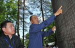
BEIJING - China has collected detailed topographic information and images of all its islands using aerial remote sensing, a method allowing the capture of data about objects from a distance.
The completion of the project marks the country's first "systematic and comprehensive" move to collect surveillance information on the more than 10,500 islands within its territory, said the State Oceanic Administration (SOA) on Friday.
It took three years of work by the aviation law enforcement forces with the China Marine Surveillance (CMS), according to an SOA statement.
The administration said that the landmasses covered are on the official catalogue of China's islands, but none fall within the country's recently established Air Defense Identification Zone.
An islands surveillance plan mapped out by the SOA in 2011 required the CMS to conduct remote sensing and collect data on all reachable islands every three years, and said that such efforts should focus on islands listed for development, rehabilitation and protection.
According to the CMS, it will cooperate with the SOA island management department and the National Marine Data & Information Service in drafting an information sharing mechanism in order to strengthen technological support for the country's law enforcement work concerning its islands.

 Successful businessman gives back to the community
 Tea with heart
 Wanting Qu: Chinese-Canadian singer-songwriter launches tour
 Ibsen gets a Chinese spin in New York
 LA rolls out the red carpet
 Airline receives its first Boeing 777-300
 Freediver takes cheeky selfie with sperm whale
 Buried gold coins unearthed in California
Most Viewed
Editor's Picks

|

|

|
|

|

|
Today's Top News
Houston-China bonds deepen with new group
Apple Inc sues China on IP
Climate law summit started in DC
China issues report on US human rights
Scholars from and on China
Baidu gets 'buy' rating from street
Program to help US minority youth
China ignores time bomb of increasing waistlines
US Weekly

|

|