History and law back China's sovereignty
Updated: 2016-07-14 07:51
(China Daily)
|
||||||||
6. In January 2013, the then government of the Republic of the Philippines turned its back on the above-mentioned consensus and commitment, and unilaterally initiated the South China Sea arbitration. The Philippines deliberately mischaracterized and packaged the territorial issue which is not subject to the United Nations Convention on the Law of the Sea (UNCLOS) and the maritime delimitation dispute which has been excluded from the UNCLOS dispute settlement procedures by China's 2006 optional exceptions declaration pursuant to Article 298 of UNCLOS. This act is a wanton abuse of the UNCLOS dispute settlement procedures. In doing so, the Philippines attempts to deny China's territorial sovereignty and maritime rights and interests in the South China Sea.
7. This paper aims to clarify the facts and tell the truth behind the relevant disputes between China and the Philippines in the South China Sea, and to reaffirm China's consistent position and policy on the South China Sea issue, in order to get to the root of the issue and set the record straight.
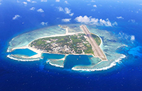
I. Nanhai Zhudao are China's Inherent Territory
i. China's sovereignty over Nanhai Zhudao is established in the course of history
8. The Chinese people have since ancient times lived and engaged in production activities on Nanhai Zhudao and in relevant waters. China is the first to have discovered, named, and explored and exploited Nanhai Zhudao and relevant waters, and the first to have continuously, peacefully and effectively exercised sovereignty and jurisdiction over them, thus establishing sovereignty over Nanhai Zhudao and the relevant rights and interests in the South China Sea.
9. As early as the 2nd century BCE in the Western Han Dynasty, the Chinese people sailed in the South China Sea and discovered Nanhai Zhudao in the long course of activities.
10. A lot of Chinese historical literatures chronicle the activities of the Chinese people in the South China Sea. These books include, among others, Yi Wu Zhi (An Account of Strange Things) published in the Eastern Han Dynasty (25-220), Fu Nan Zhuan (An Account of Fu Nan) during the period of the Three Kingdoms (220-280), Meng Liang Lu (Record of a Daydreamer) and Ling Wai Dai Da (Notes for the Land beyond the Passes) in the Song Dynasty (960-1279), Dao Yi Zhi Lüe (A Brief Account of the Islands) in the Yuan Dynasty (1271-1368), Dong Xi Yang Kao (Studies on the Oceans East and West) and Shun Feng Xiang Song (Fair Winds for Escort) in the Ming Dynasty (1368-1644) and Zhi Nan Zheng Fa (Compass Directions) and Hai Guo Wen Jian Lu (Records of Things Seen and Heard about the Coastal Regions) in the Qing Dynasty (1644-1911). These books also record the geographical locations and geomorphologic characteristics of Nanhai Zhudao as well as hydrographical and meteorological conditions of the South China Sea. These books record vividly descriptive names the Chinese people gave to Nanhai Zhudao, such as "Zhanghaiqitou" (twisted atolls on the rising sea), "Shanhuzhou" (coral cays), "Jiuruluozhou" (nine isles of cowry), "Shitang" (rocky reefs), "Qianlishitang" (thousand-li rocky reefs), "Wanlishitang" (ten thousand-li rocky reefs), "Changsha" (long sand cays), "Qianlichangsha" (thousand-li sand cays), and "Wanlichangsha" (ten thousand-li sand cays).
11. The Chinese fishermen have developed a relatively fixed naming system for the various components of Nanhai Zhudao in the long process of exploration and exploitation of the South China Sea. Under this system, islands and shoals have become known as "Zhi"; reefs "Chan", "Xian", or "Sha"; atolls "Kuang", "Quan" or "Tang"; and banks "Shapai". Geng Lu Bu (Manual of Sea Routes), a kind of navigation guidebook for Chinese fishermen's journeys between the coastal regions of China's mainland and Nanhai Zhudao, came into being and circulation in the Ming and Qing Dynasties, and has been handed down in various editions and versions of handwritten copies and is still in use even today. It shows that the Chinese people lived and carried out production activities on, and how they named Nanhai Zhudao. Geng Lu Bu records names for at least 70 islands, reefs, shoals and cays of Nansha Qundao. Some were named after compass directions in Chinese renditions, such as Chouwei (Zhubi Jiao) and Dongtou Yixin (Pengbo Ansha); some were named after local aquatic products in the surrounding waters such as Chigua Xian (Chigua Jiao, "chigua" means "red sea cucumber") and Mogua Xian (Nanping Jiao, "mogua" means "black sea cucumber"); some were named after their shapes, such as Niaochuan (Xian'e Jiao, "niaochuan" means "bird string") and Shuangdan (Xinyi Jiao, "shuangdan" means "shoulder poles"); some were named after physical objects, such as Guogai Zhi (Anbo Shazhou, "guogai" means "pot cover") and Chenggou Zhi (Jinghong Dao, "chenggou" means "steelyard hook"); still some were named after waterways such as Liumen Sha (Liumen Jiao, "liumen" means "six doorways").
- Arbitration body 'has nothing to do' with us, says UN
- Trump expected to make VP announcement on Friday
- 25 killed, 50 injured as trains collide in Italy
- The South China Sea Arbitration: Illegal, Illegitimate and Invalid
- Theresa May set to be UK's next Prime Minister after rival stands down
- Killing of UN Chinese peacekeepers slamed

 Coming-of-Age Day on the frontline of fighting floods
 Monks seek tranquility inside lotus ponds
 In pics: Top 10 livable Chinese cities
 Restaurant of 'bandits' opens in Northeast China's Jilin
 Ivanovic, Schweinsteiger holds wedding in Venice
 Tim Duncan announces retirement after 19 seasons with Spurs
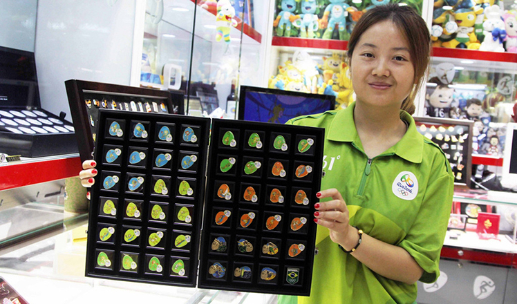 Merchandize for Rio 2016 a hit in run-up to games
 Top 10 best Chinese cities to own a house
Most Viewed
Editor's Picks

|

|

|
|

|

|
Today's Top News
Ministry slams US-Korean THAAD deployment
Two police officers shot at protest in Dallas
Abe's blame game reveals his policies failing to get results
Ending wildlife trafficking must be policy priority in Asia
Effects of supply-side reform take time to be seen
Chinese State Councilor Yang Jiechi to meet Kerry
Chinese stocks surge on back of MSCI rumors
Liang avoids jail in shooting death
US Weekly

|

|