China no longer reliant on satellite image imports
Updated: 2013-01-10 11:08
(Xinhua)
|
||||||||
BEIJING - China's first high-resolution, stereo mapping satellite Ziyuan III meets international standards, ridding the country of its reliance on imports of satellite images.
It was announced at a seminar reviewing the research and development of Ziyuan III held on Wednesday, one year after the satellite was launched.
China used to import over 90 percent of its remote-sensing data, according to the seminar.
The launch of Ziyuan III has enhanced the country's capability to capture space remote-sensing images, bolstered state security and boosted the geo-information industry.
Also according to the seminar, China plans to build a remote-sensing mapping satellite system in 10 to 15 years. Three follow-up mapping satellites are already in the pipeline.
The Ziyuan III 02 satellite is likely to be launched in early 2014, allowing the two orbiters to form a network, so that real-time data on any given point on earth can be retrieved throughout the day.
The satellite, a high-resolution remote-sensing satellite for civilian use, was launched on Jan 9, 2012. It is expected to compete with its foreign counterparts that currently dominate the country's hi-res remote-sensing and mapping market.
The satellite is tasked with offering services to aid the country's land-resources surveys, natural-disaster prevention, agricultural development, water-resources management and urban planning.
It has a designed life expectancy of five years.
Related Readings
Ziyuan III satellite expands mapping coverage
China's geoinformation industry generates 200b yuan
China to support geoinformation industry
China to launch 1st national geoinformation survey
- China mulls harsher punishments for illegal mapping
- Mobile map users to reach 600m by 2015
- China launches new mapping satellite
- China's geoinformation industry generates 200b yuan
- China to support geoinformation industry
- China successfully launches remote sensing satellite
- China to launch 1st national geoinformation survey

 Li Na on Time cover, makes influential 100 list
 FBI releases photos of 2 Boston bombings suspects
 World's wackiest hairstyles
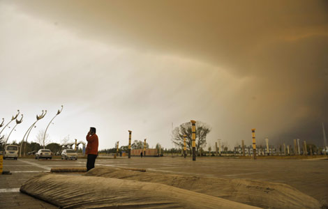 Sandstorms strike Northwest China
 Never-seen photos of Madonna on display
 H7N9 outbreak linked to waterfowl migration
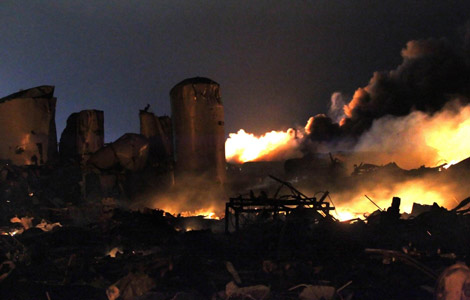
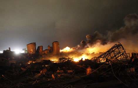 Dozens feared dead in Texas plant blast
 Venezuelan court rules out manual votes counting
Most Viewed
Editor's Picks

|

|

|

|

|

|
Today's Top News
Boston bombing suspect reported cornered on boat
7.0-magnitude quake hits Sichuan
Cross-talk artist helps to spread the word
'Green' awareness levels drop in Beijing
Palace Museum spruces up
First couple on Time's list of most influential
H7N9 flu transmission studied
Trading channels 'need to broaden'
US Weekly

|

|