Designers: Beidou progressing at rapid pace
Updated: 2013-05-15 05:32
By Hao Nan (China Daily)
|
||||||||

The first ground-based augmentation system to improve the performance of the Beidou Satellite Navigation System developed by China was approved and accepted in March in Wuhan, Hubei province.
The general index of the system's precision reached "an international advanced level", according to an evaluation committee led by Sun Jiadong, an academician with the Chinese Academy of Sciences and chief designer of the Beidou system.
Consisting of 30 ground tracking stations, an operating system and a precision positioning system, the augmentation system will significantly improve the accuracy and reliability as well as reducing the positioning time of Beidou, said Liu Jingnan, an academician of the Chinese Academy of Sciences from Wuhan University.

Established as a national pilot project, the augmentation system was planned by the central government and jointly developed by the prestigious Wuhan University and the Hubei Bureau of Surveying and Mapping using their own proprietary technologies.
In the Asia-Pacific region covered by the Beidou system, the satellites can locate a user with an accuracy of 10 meters.
Key technology
However, the positioning precision can be further improved to 2 cm in the horizontal and 5 cm in the vertical in Hubei, thanks to the three-step real-time positioning technology, industry specialists said.
This technology will be used in special industries, such as mapping, land resources and urban planning, water conservation and national construction projects.
For public uses, such as vehicle tracking and ship positioning, the system also has a single-frequency differential navigation technology that locates targets with an accuracy of 2 meters.
The Hubei Meteorological Administration also uses the services of the augmentation system to realize real-time transmission, monitoring and processing of ground-based meteorological observation data for more accurate weather forecasting.
|
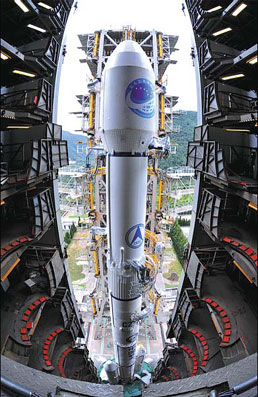
A rocket carrying a navigation satellite is ready to be launched at an astronautic center somewhere in China. |
Early in the 1980s, China began to explore the development of the satellite navigation system in line with the nation's actual conditions.
A satellite navigation system can satisfy diverse demands of society, experts said, which reflects not only a country's scientific capacities but also its comprehensive strength. In doing so, the Beidou system will play an irreplaceable role in both strategy and tactics.
The Beidou navigation project was officially carried out in 2004, aimed to provide high-quality positioning, navigating and timing services to users across the world.
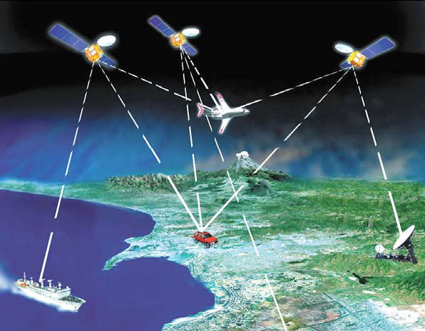
The system consists of three sectors - satellites, ground tracking stations and user terminals.
It will have a total of 35 satellites when the system is fully operational, including five in geostationary orbit.
16 satellites to date
So far, the fledgling Beidou satellite navigation and positioning system has 16 satellites hovering over the Asia-Pacific region, and 14 more satellites will be added, enabling the Beidou network to achieve a global coverage.
When it is complete, China will become the third country worldwide with an independent satellite navigation system, following the footsteps of the United States and Russia.
"China will introduce a world-leading navigation system to more than 100 cities and 200 million users across the country by 2020," Cao Jianlin, vice-minister of Science and Technology, said.
At some point, Beidou could rival the US Global Positioning System (GPS) and Russia's Global Navigation Satellite System for service around the globe, he noted.
The system can communicate with the ground stations by sending and receiving short messages in addition to the navigation and timing functions that other navigation systems can provide, he explained.
Cao added that the Beidou system will be open to foreign companies and allows interoperability with other systems.

Li Changjiang, chief commander of the Beidou system, said its success is due in part to the technology behind the atomic clock, which is the most complex one in the system.
Atomic timepieces are vital tools in the Beidou system because their accuracy and stability are key requisites, Li noted.
In addition, he said that another important application of the system is to provide precision for any transactions that requires speed and accuracy, such as bank settlements.
By the end of 2012, Beidou had provided services to more than 130,000 military and civilian users in the fields of transportation, meteorology, financial services, power generation, fishery and firefighting, according to the China Satellite Navigation Office, which is in charge of the operation of the system.
More and more Chinese cities are also applying Beidou services in their high-tech sectors.
A spokesman of the office said the Beidou system has been stable since it started trial operations at the end of 2011.
It has been widely used in such fields as national security, major national events and hydrological monitoring, and also served as an important means of communication during relief work after the Wenchuan and Yushu earthquakes, he added.
Wu Jianglong contributed to the story
haonan@chinadaily.com.cn
|
With 16 satellites currently installed, Beidou now mainly serves the Asia-Pacific region. It will eventually have 35 satellites, enabling it to cover the entire globe. Photos provided to China Daily |

|
The system consists of three sectors - satellites, ground tracking stations and user terminals. |
(China Daily 05/15/2013 page24)

 Michelle lays roses at site along Berlin Wall
 Historic space lecture in Tiangong-1 commences
 'Sopranos' Star James Gandolfini dead at 51
 UN: Number of refugees hits 18-year high
 Slide: Jet exercises from aircraft carrier
 Talks establish fishery hotline
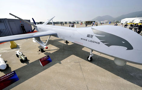 Foreign buyers eye Chinese drones
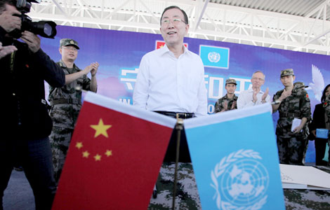 UN chief hails China's peacekeepers
Most Viewed
Editor's Picks

|

|

|

|

|

|
Today's Top News
Shenzhou X astronaut gives lecture today
US told to reassess duties on Chinese paper
Chinese seek greater share of satellite market
Russia rejects Obama's nuke cut proposal
US immigration bill sees Senate breakthrough
Brazilian cities revoke fare hikes
Moody's warns on China's local govt debt
Air quality in major cities drops in May
US Weekly

|

|