Tropical Storm Karen aims for US Gulf Coast
Updated: 2013-10-04 02:26
(Agencies)
|
||||||||
 |
|
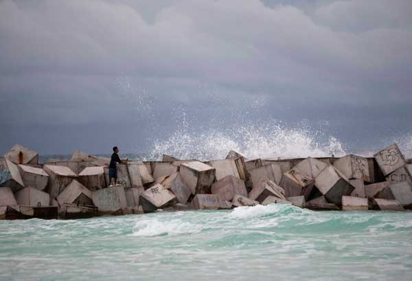
A man fishes while standing on wave breakers in Cancun October 3, 2013.[Photo/Agencies] |
MIAMI - Tropical Storm Karen formed in the southeastern Gulf of Mexico on Thursday and could become a hurricane before hitting the US coast between Louisiana and the Florida Panhandle, forecasters at the US National Hurricane Center said.
Energy companies began evacuating some workers from oil and natural gas platforms in the Gulf of Mexico on Wednesday.
Anadarko Petroleum Corp said Thursday it had shut production at its Neptune platform, which has capacity to produce 14,000 barrels per day of oil and 23 million cubic feet per day of natural gas.
The storm, the first to threaten the US coast during the 2013 Atlantic hurricane season, had top winds of 65 mph and was centered about 485 miles south of the mouth of the Mississippi River.
It was moving north-northwest and was expected to turn north, hitting the US coast near the Mississippi-Alabama border on Saturday.
A hurricane watch was issued for the coast from Grand Isle, Louisiana, eastward to Indian Pass, Florida, alerting residents to expect hurricane conditions within the next 48 hours.
Karen would become a hurricane if its sustained winds reach 74 mph. That was expected to happen late Friday.
"Some weakening is anticipated as Karen approaches the Gulf Coast but the storm could still be near hurricane strength at landfall," the forecasters said.
A tropical storm watch was in effect in Louisiana from Grand Isle west to Morgan City, and for New Orleans, Lake Maurepas and Lake Pontchartrain. Tropical storms carry winds of 39 mph to 73 mph.
Heavy rains were forecast all along the northern Gulf Coast, and locally heavy rain could also affect parts of Cuba and Mexico's Yucatan Peninsula in the next couple of days, the forecasters said.
The Hurricane Center forecasters were exempt from the US government shutdown because their work is vital to protecting life and property. But their parent agency, the National Oceanic and Atmospheric Administration, advised that some weather satellite images available to the public on its website "may not be up to date" because of the shutdown.

 Driver shot dead in car chase at US Capitol
 NY SUV driver's wife: We were in 'grave danger'
 Death toll in sunk boat off Italy could top 200
 A southern staple
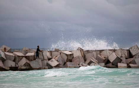 Tropical Storm Karen aims for US Gulf Coast
 City rush, island time
 Death toll in Italy migrant boat wreck rises to 94
 Lang Lang: First Chinese winner of Classic Brits Award
Most Viewed
Editor's Picks

|

|

|
|

|

|
Today's Top News
Twitter unveils IPO filing, aims to raise $1 b
US hints Iran could get some sanctions relief
Gunfire forces brief lockdown at US Capitol
Death toll in sunk boat off Italy could top 200
NY driver's wife says in danger
Call for new 'maritime silk road'
Shutdown in third day
Plane crash kills 15 in Nigeria
US Weekly

|

|